Set up a battle-map grid
Import a map, align its square or hex grid, and set the scene's distance scale.
Every scene owns its grid. The active system supplies sensible starting values, but changing one scene never changes another map in the world.
#Import the map
On an empty scene, choose Upload map and select an image. Aether reads the image dimensions and uses them as the scene bounds on that first import. Replacing a map later keeps the bounds you have already calibrated. To replace or clear the image later, open View → Current Scene. Clearing it leaves the scene bounds and Scene Builder structure in place.
#Line up a square grid
Open Grid setup
Choose Grid setup in the map tool rail. The controls update the canvas while they remain open.
Match the cell size
Set Cell size to the number of image pixels between two printed grid lines. Use a large, uninterrupted part of the map: an error of one pixel becomes obvious after ten cells.
Move the origin
Adjust X origin and Y origin until Aether's lines sit over the printed ones. The origin is measured from the image's upper-left corner.
Make the overlay readable
Choose the grid colour and opacity for this scene. These change the overlay only; they do not alter the imported image.

#Use hexes or no grid
Choose Hex for a real axial hex grid, then choose Pointy top or Flat top. For hexes, cell size is the centre-to-centre distance across a shared side. Tokens snap to hex centres; Aether does not expose odd-row or even-row offset bookkeeping.
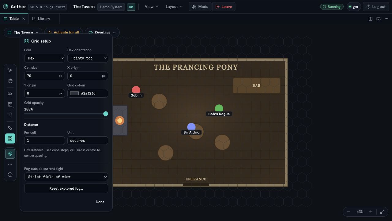
Choose Gridless when the image has no cells. Aether draws no grid and disables snapping for that scene. Your snap preference is retained for the next gridded scene. Cell size remains available as the pixel scale used by measurement.
#Set distance and units
Under Distance, set the value represented by one cell and its unit, such as 5 and ft. Choose
how square-grid diagonals count:
- Euclidean measures the geometric line.
- Equal (1-1-1) counts a diagonal as one cell.
- Alternating (1-2-1) alternates one and two cells for diagonal steps, carrying the sequence across ruler waypoints.
Hex distance always uses cube steps. Gridless measurement is Euclidean and uses the scene's pixel scale.
The system provides defaults when a scene is created or first upgraded. The scene stores the result,
so installing a later version of the system does not silently change distances on maps already in
use. If a system supplies nothing, Aether falls back to 1 units and Euclidean diagonals.